Friday, November 18, 2022

Inspired by books: The Northern Lights

 I began to read books about kayaking adventure, and on kayaking technique, in my teenage years. Nowadays, many of the books, both old and new, on my shelves are about travel exploration, and often relate in some way to kayaking, sailing, mountaineering, or the arctic. Inevitably one adventure leads to another, just as one explorer inspires others. The stories in these books frequently overlap, or cross reference the adventures of others. I enjoy following the links; those little cross-references that spring up unexpectedly between them. In that way my collection has grown and diversified.

Glow of Northern lights starting up in northern labrador
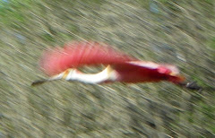
The northern Lights begin to glow over northern Labrador


I am not alone in my delight. My friend Kevin Mansell, from Jersey in the Channel Islands, has a similarly diverse and prized collection, although most likely fuller than mine. 

In New Zealand, I have seen Paul Caffyn's enviable library. Both Mansell and Caffynl are personally familiar with adventure, embarking on early groundbreaking kayak expeditions, and both also collect kayaking related stories among other subjects. Caffyn has written several books. But it was seeing a photo of Kevin’s bookshelves that made me question my hoarding. Sure, I refer to them all the time in research for writing. Is that why I surround myself with books in my tiny office?

To ponder this question, I pulled a book from the shelf. The explorer Gino Watkins having recently cropped up in conversation, the book I chose was “Northern lights”. I knew where it was located, but if I had asked someone else to find it, they might have pulled any one of three books from the shelves, each with a similar title.

Books titled Northern lights
Three books with similar titles

 “Northern Lights”, published in 1932, recounts the British Arctic air route expedition from 1930 to 1931, Written by Spencer Chapman, it is a revealing book about British Arctic exploration in Greenland, illustrated with black and white photographs. It offers a fascinating insight into their use of small, lightweight, Moth biplanes, fitted as needed with floats or skis, which helped with their mapping. It was in a Gypsy Moth that my father later learned to fly.

Title page of the book northern Lights, by Spencer Chapman
Northern Lights: about Greenland


Chapter 12 in Northern Lights describes the art of kayaking
Chapter XII about The Art of Kayaking

During their stay in Greenland, Gino Watkins' team learned from the Inuit how to fish from the ice, hunt from kayaks, and handle sled dogs. As a kayaker, I was delighted to find a whole illustrated chapter titled “The Art of Kayaking”, which title, coincidentally, I chose as the title for my recent book on kayaking technique. Chapman’s chapter begins with the focus on hunting seals.

Map of Greenland coast from aerial survey
The Greenland expedition used Moth aircraft for aerial surveys

The second book, also “Northern Lights”, was written by Desmond Holdridge and published in 1939. It narrates the story of a 1925 sailing trip to northernmost Labrador. What inspired Holdridge to write about his adventure thirteen years later was the book he had just read. That was “Northernmost Labrador, mapped from the air” by Alexander Forbes, about his exploration and mapping from the air around the entrance to Hudson Strait, a book also on my shelf not gathering dust. 

Book, Northern lights by Holdridge about Labrador
Northern Lights, about Labrador

Map of Labrador sailing route in Northern lights
Inside cover maps Labrador sailing route

In 1925 Holdridge, with two companions, sailed a small schooner from Nova Scotia to Killiniq Island at the northernmost tip of Labrador, (now part of Nunavut) and most of the way back, before sinking. His account describes many of the Inuit settlements that at that time populated Labrador, describing the people and the nature of the coast. The story, wonderfully descriptive and easy to read, is a treasure trove of information about Labrador, a precious resource to me. I describe my own, much later adventures to the northern tip of Labrador, by kayak in the book: On Polar Tides

Northern Lights over Labrador
Northern Lights over Labrador from the book On Polar Tides

One of the wonders of traveling in that part of Labrador is the nightly spectacle of the aurora borealis; the northern lights, after which these books were named. Vast dancing curtains of green and red lights play across the backdrop of starry skies. Having seen the spectacle, who would not yearn to learn more? So, on target, the third book, titled "The Northern Lights” was written by Lucy Jago and published in 2001.

The Northern Lights by Lucy Jago
The Northern Lights, about the Norwegian scientist who unlocked the mystery of the auroras.

It is the story of the man who unlocked the secrets of the Aurora borealis. Jago’s research revealed the fascinating life of Norwegian scientist, and inventor, Kristian Birkeland who lived from 1867 to 1917. He successfully predicted that plasma was present everywhere in space, and he was the first to explain the nature and behavior of the solar wind. His theory of the cause of the auroras was proven to be correct in 1967 after a probe was sent into space. Of course, much more has been learned about space and the universe since 1917. Brian Greene’s books, also on my shelf, offer more recent perspectives. But his subject matter leads me into other wormholes.

Map of Birkeland's arctic stations
Birkeland set up arctic stations to study the northern lights

Each of these three “Northern Lights” volumes is precious to me, but collectively they are even more so for the ways they knit themselves together, while also pointing me off in new directions. The questions they inspired led me down myriad paths into other books that now grace my shelves. All are interconnected by that invisible web. I need only open one book to recall the links to many of the others.

I owe so much to books, I offer my thanks to those who take the time to write them. 


Saturday, September 17, 2022

One Big Asteroid affected Denmark

 Stevns Klint, in Denmark:

When my friend Mette Carr invited me to join a Køge Kajak Klub kayaking tour along Stevns Klint, I leapt at the chance. These club members know their spectacular white cliffs well, so as we paddled, I was treated to a host of details about this UNESCO World Heritage site. 


Stevns Klint, Denmark

The Greenland-paddle maker Erik Vangsgaard, and his wife, also Mette, pointed out rickety ladders dangling from the cliffs here and there. These were structures, built by landowners above, to access the hidden cobble beaches at the base of the cliffs. I wonder how often these ladders fail. Each appeared to be a hodgepodge of steps and sections of ladder roped together, spidering down the face.


Rickety steps and ladders dangle from the cliff

 "Mette grew up here." Erik pointed up the cliff. "Her father built a staircase down the cliff, and when she was little she used to have a hut on the beach, where she kept chickens and rabbits. There was nowhere for them to escape to, so they could run free on the beach."


Erik in his paddle-making workshop

Stevns Klint has been recognized as a UNESCO World Heritage Site since 2014. These chalk and limestone cliffs to the south of Copenhagen Denmark, mark the place where Luis and Walter Alvarez, father and son, analyzing the dark fish clay layer above the Cretaceous chalk, found the inches-thin thin layer enriched with iridium. 

Geologically, the fish clay layer represents the end of the Cretaceous, the demise of the dinosaurs and the start of the Tertiary (Paleogene) at one of the five major known extinction events in the history of life on Earth. Iridium is associated with meteorite impact. Alvarez argued that this layer represented the deposited remains of the creatures killed when an asteroid hit Earth at what is now Chicxulub, on the Yucatan Peninsula in Mexico. 


Stevns Klint: located south of Copenhagen, Denmark


The fish clay layer traces a narrow line across the cliff, sandwiched between the Cretaceous chalk below, and the Tertiary limestone above. The chalk below the fish clay, and the limestone immediately overlying it, erodes more readily than more recent limestone, which overhang like a shelf. 

Hard Tertiary limestone juts out like a shelf

 
A thin wavy orange line here is the fish clay

The hard overlying limestone shows evidence of earlier quarrying. At one time, workmen cut rectangular blocks from the cliff. Lowered down and transported by small boats, many of these blocks were used for building in Copenhagen. 

Højerup church was built from local limestone in 1200.
 

Built from this local limestone in about the year 1200, the Højerup church was not always this close to the cliff. Over the centuries, the sea eroded the cliff back first to the graveyard and eventually to the church until, in 1928, the chancel collapsed and fell with the cliff edge. The rest of the church still stands, now bulwarked to delay further loss, offering a sweeping view of the bay below. Meanwhile, a new church, completed in 1913 to replace it, stands well back from the edge. 

Højerup church perches on the edge above the bay. 
 

Face carved into limestone at Højerup church


 There are shallow natural caves beneath the cliff, which echo with the hollow sounds of waves tumbling flints. But there are also man-made holes that penetrate the cliff, albeit gated from access. These offer the only visible evidence, from the seaward, of the fortress that hides within.

Entrance to natural sea cave

 
White eroded chalk at rear of cave above flint beach


Cliff entrance to underground fortress

Almost a mile of tunnels run through the cliff, 60 feet beneath the surface, forming the once top-secret fortress. Built in 1953 during the Cold War, the fortress was designed to withstand a nuclear attack. It remained operational until the year 2000. Now it is open to visitors as a museum with guided tours showing former underground living quarters, command centers, and military equipment. 


Asteroids do still hit earth occasionally. Will Earth’s next mass extinction be due to such a collision? The asteroid that caused the K-T extinction event, (K for Cretaceous and T for Tertiary), responsible for the fish clay layers, was estimated to be about 12Km across. NASA keeps track of several hundred of more than 2,000 asteroids it identifies as potentially hazardous. What will happen when they spot one on a collision course with earth? Rather than waiting, hoping for the best, in July NASA launched the DART mission. A half-ton spacecraft aims to meet the 500 feet wide moon of the asteroid Didymos as it passes seven million miles from earth. 


Taking a break beneath the cliff. Fish clay is at shoulder height.

If all goes as planned, the spacecraft will eject a camera to document what happens when a half-ton spacecraft slams into an asteroid at 14,700 miles per hour. The collision should occur in October 2022, and the result should give scientists the first hint of how effective the technique might be in deflecting an asteroid from a path toward earth.

If you enjoyed my post, you may appreciate my book: Encounters from a Kayak.

(Thanks to Køge kayak club for such a fun trip, and especially Erik Agertoft for loaning me his Whisky16 kayak.)