“Watersheds are difficult places to map, and for that reason (among many others) they are the most fascinating places in the world to explore – debatable lands.” William Bliss
The Seattle Times today names
Imagine a gradually rising sea level flooding some homes while others further inland become waterfront property, in the meantime the weather changing a bit and up to 70 percent of all plant and animal species have become extinct, as predicted. Check the plant nursery catalog… we might have to change the type of grass that makes the lawn.
Let’s look at another idea… a slightly different scenario described by the so-called “Ancient Mariner” in William Bliss
 |
| Rapid Rivers by William Bliss, published 1935 |
But more about rising sea levels; London already built a flood barrier across the Thames to prevent storm surges, which, fueled by the combination of low atmospheric pressure, high tides and wind pushing the North Sea into the land-funnel of Dover Strait, and into the Thames Estuary, occasionally threatened to put London underwater. Since devastating floods in the 1950’s the Netherlands built dikes along the coastal islands, and barriers between, to protect the lowlands of Holland against the same threat. In Holland, pumping the enclosed land dry has caused the land to shrink, not in area but in volume. In places the land is already more than 14 feet below sea level. Given a rise in sea level of 4.6 feet I can imagine Florida either substantially flooded or else, barricaded by dikes, surviving like Holland below sea level. Likewise vast areas of G eorgia , the Carolinas… well, you can figure out where the low spots are!
 |
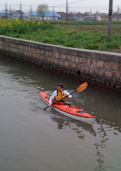
| A canal in Delft |
Ten ago, 1997, Sea Kayaker Magazine published an article about kayaking below sea level. (I just posted it to my web-site.) 1997: the year of the Kyoto Protocol. We are at a watershed; our decisions now make a difference. In another ten years of global warming, 2017, when the residents of Asia’s large cities are predicted to be at great risk of flooding, we might be able to kayak below sea level in our own back yard.


