Stevns Klint, in Denmark:
When my friend Mette Carr invited me to join a Køge Kajak Klub kayaking tour along Stevns Klint, I leapt at the chance. These club members know their spectacular white cliffs well, so as we paddled, I was treated to a host of details about this UNESCO World Heritage site.
 |
| Stevns Klint, Denmark |
The Greenland-paddle maker Erik Vangsgaard, and
his wife, also Mette, pointed out rickety ladders dangling from the cliffs here and
there. These were structures, built by landowners above, to access the hidden
cobble beaches at the base of the cliffs. I wonder how often these ladders
fail. Each appeared to be a hodgepodge of steps and sections of ladder roped
together, spidering down the face.
 |
| Rickety steps and ladders dangle from the cliff |
"Mette grew up here." Erik pointed up the cliff. "Her father built a staircase down the cliff, and when she was little she used to have a hut on the beach, where she kept chickens and rabbits. There was nowhere for them to escape to, so they could run free on the beach."
 |
| Erik in his paddle-making workshop |
Stevns Klint has been recognized as a UNESCO World Heritage Site since 2014. These chalk and limestone cliffs to the south of Copenhagen Denmark, mark the place where Luis and Walter Alvarez, father and son, analyzing the dark fish clay layer above the Cretaceous chalk, found the inches-thin thin layer enriched with iridium.
Geologically, the fish clay layer represents the end of the Cretaceous, the demise of the dinosaurs and the start of the Tertiary (Paleogene) at one of the five major known extinction events in the history of life on Earth. Iridium is associated with meteorite impact. Alvarez argued that this layer represented the deposited remains of the creatures killed when an asteroid hit Earth at what is now Chicxulub, on the Yucatan Peninsula in Mexico.
 |
| Stevns Klint: located south of Copenhagen, Denmark |
The fish clay layer traces a narrow line across the cliff, sandwiched between the Cretaceous chalk below, and the Tertiary limestone above. The chalk below the fish clay, and the limestone immediately overlying it, erodes more readily than more recent limestone, which overhang like a shelf.
 |
| Hard Tertiary limestone juts out like a shelf |
 |
| A thin wavy orange line here is the fish clay |
The hard overlying limestone shows evidence of earlier quarrying. At one time, workmen cut rectangular blocks from the cliff. Lowered down and transported by small boats, many of these blocks were used for building in Copenhagen.
 |
| Højerup church was built from local limestone in 1200. |
Built from this local limestone in about the year 1200, the Højerup church was not always this close to the cliff. Over the centuries, the sea eroded the cliff back first to the graveyard and eventually to the church until, in 1928, the chancel collapsed and fell with the cliff edge. The rest of the church still stands, now bulwarked to delay further loss, offering a sweeping view of the bay below. Meanwhile, a new church, completed in 1913 to replace it, stands well back from the edge.
 | |
| Højerup church perches on the edge above the bay. | |
 |
| Face carved into limestone at Højerup church |
There are shallow natural caves beneath the cliff, which echo with the hollow sounds of waves tumbling flints. But there are also man-made holes that penetrate the cliff, albeit gated from access. These offer the only visible evidence, from the seaward, of the fortress that hides within.
 | |
| Entrance to natural sea cave |
 |
| White eroded chalk at rear of cave above flint beach |
 |
| Cliff entrance to underground fortress |
Almost a mile of tunnels run through the cliff, 60 feet beneath the surface, forming the once top-secret fortress. Built in 1953 during the Cold War, the fortress was designed to withstand a nuclear attack. It remained operational until the year 2000. Now it is open to visitors as a museum with guided tours showing former underground living quarters, command centers, and military equipment.
Asteroids do still hit earth occasionally. Will Earth’s next mass extinction be due to such a collision? The asteroid that caused the K-T extinction event, (K for Cretaceous and T for Tertiary), responsible for the fish clay layers, was estimated to be about 12Km across. NASA keeps track of several hundred of more than 2,000 asteroids it identifies as potentially hazardous. What will happen when they spot one on a collision course with earth? Rather than waiting, hoping for the best, in July NASA launched the DART mission. A half-ton spacecraft aims to meet the 500 feet wide moon of the asteroid Didymos as it passes seven million miles from earth.
 |
| Taking a break beneath the cliff. Fish clay is at shoulder height. |
If all goes as planned, the spacecraft will eject a camera to document what happens when a half-ton spacecraft slams into an asteroid at 14,700 miles per hour. The collision should occur in October 2022, and the result should give scientists the first hint of how effective the technique might be in deflecting an asteroid from a path toward earth.
If you enjoyed my post, you may appreciate my book: Encounters from a Kayak.
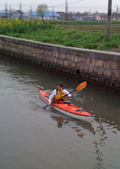
(Thanks to Køge kayak club for such a fun trip, and especially Erik Agertoft for loaning me his Whisky16 kayak.)