Tuesday, October 9, 2012

Rising sea levels & faster-rising land affect Viking settlement Birka


Squeezing through reed beds
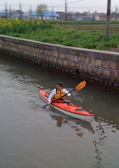
There are Arthur, Roland and me… just three of us pushing into the westerly breeze across Lake Malaren toward the island Bjorko. Once in shelter we sneak up the eastern side through reed beds beside dense woodland to approach our landing in the northeast. Maybe we’ll have wind at our back for the return.          

 Two tour boats and a number of small sailboats cluster around the sheltered harbor Angholmen. The island looks sleepy. But maybe as long ago as 3,500 years ago the island was used by Bronze Age hunters. There are nine Bronze Age burial cairns at the south end, but what’s better known is that during the 8th and 9th century AD there was a bustling Viking market town here; an important trading center.

 
These lake islands have dense woodland to the shore
We change from our paddling gear, fire up a stove in the shelter of a tree and make espresso. After lunch we go exploring. First there’s a small museum that shows a lot about the town as it would have been, with an amazing model of the village and fortifications. That’s useful to get an idea of the layout, because much of what remains is below ground, covered by a skin of turf. It’s also an opportunity to see replicas of relics found here, and examples of building techniques.


What we can see is a high outcrop of rock inside the hill fort, Borg. From the top of the rock is an impressive view across the lake and islands.
Wide view from the Viking hill fort Borg
Turning to look inland we can see the retaining fort rampart and ditch, with its gateways. It reminds me of the hill forts on the Sussex SouthDowns in England I used to play in as a kid, although this is much more recent. Outside the fort rampart was once the town, with its own defensive rampart across the valley. This area is currently known as the “black earth”, on account of the color of the earth beneath the grass. This gave early archaeologists an indication that a settlement of some size once stood here. Given the building materials of the period, wood and thatch, there were likely plenty of house fires during the period of occupation adding to the ash from fireplaces used for cooking or metalwork and other refuse that would create the rich soil.

We explore the ramparts of the Viking fort


Outside the distant rampart surrounding the town site is a graveyard, “Hemlanden” (homeland). It’s the largest of its age in Scandinavia and holds some 1,600 graves in the form of barrows, stone ships and stone circles. The island holds more than 3,000 such graves. 


So many graves indicate what a large population center Birka became at that time. Starting in the early 800’s as a trading center, it first traded with south-west Europe, but later switched to trade mostly with the east, with such places as Tashkent and Samarkand. Trade is a two-way process, so goods manufactured in Birka, such as the characteristic oval brooches worn by women, have been found in graves in Russia, while Islamic and Byzantine coins have been found at Birka, along with remnants of other trade goods.
Small Viking boats wait in the reeds
 

We visit a group of reconstructed houses and garden plots In a small bay on low land that in Viking days would have been below sea level. This hamlet is used both by historians to learn about the building methods used back then, and to educate visitors. Nestled in the reeds nearby against a narrow wooden dock are a few small Viking boats. Adding color to the scene are small groups of people “living the Viking life” dressed in historically correct clothing, cooking over fires and carrying out what would likely have been daily tasks back then. This realistic play-acting reminds me how little things change through the centuries. Many people around the world still live in much this way.

Viking building methods were used in these reconstructions

 We walk the island, between the mounds of the ancient burials, and around the defensive ramparts that once were fortified with wooden walls and towers. It’s easy to imagine the attraction of this site when it was inhabited, but what happened to the population when it declined as a town?


More than 3,000 Viking burial mounds have been found here

Nobody knows that, but it’s known that power shifted next to the town of Sigtuna on the mainland and later again to Stockholm. When Birka was occupied, it was in a bay of the Baltic. That bay reached far inland which being relatively difficult to navigate, added some natural safety from random attack. 


Stockholm sits where the lake meets the sea
As land levels lifted following the ice age, the rock ridge on which the old town of Stockholm stands dammed the bay and created rapids. The body of water above the rapids became Lake Malaren. By 1200 boats arriving at the entrance found the water so shallow they had to unload goods to haul the boats up. 

Point65's Richard Ohman approaches the lock in Stockholm


 Now Stockholm guards the entrance to Lake Malaren and its locks allow boats to drop smoothly from the lake on average 0.7 meters to sea level. The land is still rising, though less slowly now, at a rate of about 1 cm per year.

Evening, the lake side of the lock


 More about Birka

Thursday, September 27, 2012

Kayaking with the Swedish Outdoor Academy in BohuslÓ“n


From a dream I awake in BohuslÓ“n in a car. Back-seat sleeping beats back-seat driving. Sleepily I follow Felix and Axel from Point65 to join outdoor people from all over the world for the Outdoor Academy of Sweden

From Grebbestad we were about to float out in groups between the islands and rocks of the Swedish west coast archipelago, paddling Point65kayaks. But first, there are several sponsors and in the building with all the kayaks are neatly arranged piles of equipment, one for each person and some for each tent group. We don’t need to bring much of our own: this trip will be a showcase for Scandinavian design.
Leading my group from the beach is Christina who guides trips in the archipelago for a living. I’m comfortable from the moment she starts. Some of her first words explain how much she is love with the rocks. 

BohuslÓ“n is a place of rock and water. The ice sheet of the last ice age smoothed the rock surfaces, grinding them smooth as silk, and leaving subtle curvaceous edges between undulating faces. Stones frozen into the slowly moving ice gouged grooves across that suggest the work of a giant comb. The sea has since added its mark on the slowly rising land, and the salt creates a border, allowing the gradation of more or less salt-tolerant species to cling to the faces in different colored bands. Above I see tiny flowering plants clinging to cracks, and the lichens and mosses, trees and grasses that sometimes struggle to make this part of Sweden their home.

It is autumn. Already I hug my arms close and hide my fingers from the breeze. The leaves are turning brown.  Rose hips and rowan berries glow a startling scarlet. The sun is out and the visibility is so good, we see the most distant islands looming in mirage above the horizon. Here is a playground that begs to be explored. We can only scratch the surface. This is just a preview. 

We pass a lighthouse, tuck behind islands and between rocks. Here and there the professional photographers hop ashore and run up the rocks to catch the best camera angle as we pass.

We land on a tiny sand beach, just big enough for all our kayaks. In minutes the Tentipee tents are raised like pyramids on the flat grass. Out from the hatches come the Primus stoves and the food packs, water bottles and wine sacks. 

While some change from paddling gear into the warm and dry layers provided by Didriksons, others fire up the stoves. Christina pulls a Grandfors axe and a saw from somewhere deep in her Whisky16 and begins to prepare a woodpile. She saws logs and branches into short pieces then splits them into sticks. We’ll have a fire but we don’t need a furnace. 

Then sparks fly! We each have a “Light-my-Fire” knife with its special magnesium bar in the handle, and a stick of special wood, aromatic with its natural oils, to peel into tinder. One stroke of the magic stick with the back of the blade sends a cascade of sparks to the tinder, and in no time we have fire. 


Finally we all gather to eat. Christina has brought smoked salmon for tonight, reindeer meat for tomorrow. Swedish design comes forward again with dishware by “Light-my-Fire”. We eat with “Sporks”.

The Scandinavian Outdoor Group (S.O.G.) was created in 2000 as an industry initiative to help outdoor retailers and manufacturers in the export market. It is a collaboration of main players in the Outdoor industry from all five countries; Norway Sweden Finland Denmark and Iceland. Here in BohuslÓ“n with the Outdoor Academy of Sweden (O.A.S.)I have the pleasure to meet not only representatives from Scandinavian manufacturers but also journalists, retailers and tour operators from around the world. Around the fire my companions are Swedish and Japanese, Korean-Swedish and French, German, English and Russian. I love it!

Some of us rise before dawn to catch the magic light of first sunrise. While the professionals catch their digital magic I climb the island and stroll along the top. Here is a boulder-field like a beach of lichen-crusted heads with a rose bush heavy with red hips, and some blonde grasses. Suddenly the first of the sunlight hits the tops of the heads with a wine-colored glow. I’m stopped in my tracks. One moment like this is a thousand songs. When I turn back against the sun I’m captivated by the subtle snake-path of a slight ridge between two ice-smoothed slopes. On side one the crystals and tiny lichens are casting shadows, while the other for the moment is just in shadow, highlighting the curves between.


For a full day of sun we explore the islands, stopping by a small town where small rust-colored houses cluster around a church with a spire. FjÓ“llbacka is the setting for writer Camilla Lackberg’s crime novels. Already one of the hottest crime writers in the world, Lackberg is likely to become even better known soon. Later this year the first of a new collection of 10 TV movies based on Lackberg’s books and filmed here will be released. 
We weave a different route north than our way south, finally finding our place for the night on the tiny island KÓ“ften, where Jean Marc beckons me across the rock to see the last glow of fire in the sky from sunset.


I am woken by wind-driven rain against the Tentipi. It’s still dark but O.A.S. has plans for today that mean we must launch at first light. I fumble to pack in the dark with my tent-mates until finally I feel my headlamp and set it glowing. Then we drop the tent and load our hatches before breakfast. It’s rainy and windy and a struggle for the least experienced paddlers but we arrive with smiles at Grebbestad by 9 am. Once the gear has been sorted we all leave for the business side: meetings at a special location, Nordens Ark. 

Nordens Ark is a place dedicated to the preservation of endangered species. Our tour is rapid due to the rain, but we see snow leopards and white backed woodpeckers and lynx on our way to dine. It’s a very special dining room with long windows. It’s located in the wolf compound, and the wolves, feeling safe in their enclosure trot around right outside the window as we eat.

It’s a fitting end to a wonderful islands experience, because it reminds me how fragile this world we enjoy is. The wildlife is part of the whole experience. We have seen seals and birds and with the start of the lobster fishing season we have watched all the small boats head out to set their pots to reap their harvest.  We have landed in places that hold no footprint and taken away photos and mental images and friendships, yet without our care these islands would change for the worse, and quite rapidly. The experiences and networking within our group can only serve to help.


Satisfied we left BohuslÓ“n as we found it, I know I will return. I love this place. Thanks O.A.S!

See another perspective with the Outdoor Academy of Sweden blog

Monday, September 10, 2012

Trouble in Mind: revisiting Rain City


Yesterday Seattle came close to reaching a 1951 record by stretching out a dry spell to about 49 consecutive days. It finally sprinkled last night (9/10 September) to leave the foliage gleaming with droplets by morning. The 1951 record was 51 days. That for a town often referred to as “Rain City”.

Rain City

But why Rain City? Perhaps because the dry sunny summer period typically only lasts from May to late September, with plenty of days with rain through the rest of the year? Seattle does have several other nicknames, including The Gateway to Alaska, Queen City, Jet City, and Emerald City.
Rain City is the fictional city in which the 1985 film noir “Trouble in Mind” was set. Did Seattle appropriate the nickname “Rain City” from that film? Or was the name in the film taken from Seattle’s nickname? The movie was filmed in Seattle.


Director Alan Rudolph chose some of the meaner areas of Seattle on the edge of downtown, beneath overpasses and under the monorail for much of his filming. He took over a derelict corner property in a downtown building to create a café as a center point. In the opening scene in which Kris Kristofferson leaves prison having served a sentence for murder, Marianne Faithful sets the mood with the opening song, an appropriately raspy rendition of the slow 8-bar blues song, Trouble in Mind written by jazz pianist Richard M Jones (first recorded with Thelma La Vizzo accompanied by Jones on piano in 1941). Actors include Kris Kristofferson, (as Hawk) Genevieve Bujold, Joe Morton, Lori Singer (as Georgia) and Keith Carradine (as Coop).

The action of this retro futuristic melodramatic gangster romance culminates in a shoot-out at the luxury residence of the smooth gangster character Divine. For suitable opulence the film uses the Seattle Asian Art Museum in Volunteer Park. Cleared of its usual displays, the museum is transformed into an art-moderne mansion with armed guards at the gates, and decorated throughout with wonderful paintings and sculptures on loan for the film by northwest artists. During the course of the action late in the film one large painting is destroyed spectacularly over someone’s head, while a bullet smashes a large glass installation by Dale Chihuly, something some of Kristin’s artists friends delight in replaying. 

Hawk,Georgia and Coop.


Watching the film this week, Kristin Nelson pointed out one of her ceramic sculptures she loaned for the mansion scene. The scene was full of work from the local art scene. “But it was a budget production” she explained. “You can tell by the length of the credits; we all had our names in the credits instead of being paid, so the credits are very long!” Sadly the credits weren’t quite accurate… they misspelled her name!

Trouble in Mind is a thought-provoking film. The characters come together each in their own style, as if from different times, or as caricatures from an old comic book. The film is ambiguously set in the future or past, so after than 25 years later I think it still looks fresh. 
Seattle Asian Art Museum

Yesterday the Seattle Asian Art museum with its pair of sitting camels guarding the main entrance looked serene in its summer setting. Currently showing inside is the Ramayana exhibition of 44 works of Indian art from 16th century onward. There is no sign of smashed glass or blood stains. Nearby and also within Volunteer Park is the park conservatory: a mini crystal palace full of wonderful plant specimens from around the world. The conservatory this weekend celebrated its 100th anniversary. Happy anniversary!